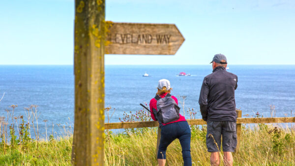
In July 2014, over 2.5 billion people watching TV marvelled at the beauty of the Yorkshire Dales during the first two days of the Tour de France. These people saw what many of us already knew, that here on our doorstep is some of the most magnificent scenery in the country, if not in the world.
I have been walking these broad acres of the Dales now for over 50 years, originally with my parents but also when I was in Scouts and have led many youngsters from the Scout Group I was leader of for many years on various walks. I have also written extensively in Dalesman and Cumbria magazines and I am also a published author of walking books.
Over the next three months, I have chosen three walks to take you on. I have walked these many times and they are in contrasting areas giving some diversity to the type of walking. The first one is a family friendly walk at Ingleton following the trail round the Ingleton waterfalls with superb views of Ingleborough at the halfway point.
On each of the walks, as well as a brief description of the route itself, I will include details of some of the history of the areas that you will pass through during the walk which I hope will add some enjoyment to your day out.
INGLETON WATERFALLS WALK
The walk starts from the Car Park near to the entrance to the falls and is well signed from the A65 road from Settle to Kendal. There is a fee for parking and entrance to the Waterfalls Trail (currently £6 per adult or £15 for a family of 2 adults and up to 3 children). However, don’t let this put you off as the splendour of the walk is well worth the cost. Whilst the walk is suitable for children, it is somewhat difficult for toddlers in pushchairs as there are a substantial number of steps to ascend and descend on the walk and they would therefore have to be carried up and down these. Children can buy an activity pack from the Ticket Office (price £1.00) which includes an activity sheet and pencil. They need to find the 10 wooden marker posts around the trail, shown marked on the map, take a pencil rubbing at each marker post, and complete the Word Search and Quiz Questions Also, responsible dog owners are welcome to use the trail. On certain sections of the trail and when crossing farmland dogs must be kept on a lead.
Ingleton is famous for walking, hiking and caving and is a thriving tourist attraction. The River Doe and the River Twiss join together in the town to form the source of the River Greta. Throughout history, the Romans, Celts, Vikings and Normans have all left their mark on Ingleton and its surrounding area. The village nestles at the foot of Ingleborough – probably the most easily recognised of the Three Peaks due to its flat summit. Nearby are a number of caves popular with tourists – White Scar Caves, Ingleborough Cave and Gaping Gill. Here, the 365 ft (111 m) cavern can be visited by tourists on bank holidays when a winch is set up to take the public down to this underground wonderland.
The village of Ingleton has a history going back to the Iron ages, when a fortress existed on top of Ingleborough. Mary Doyle, the mother of Sir Arthur Conan Doyle, lived in Masongill, a small hamlet nearby, and the man himself would have been a regular visitor to the area, as were other poets such as Thackary, who visited Masongill House many times. A brass in the church commemorates the death of one Randall Hopley Sherlock, brother of the Reverend Sherlock (vicar of Ingleton), struck by lightning at Ingleton station. And with the area below the prominent viaduct that crosses the valley in the village called the Holmes (Holme Head etc), one can only speculate about the origin of the name of a certain detective!
The famous Ingleton Waterfalls Trail that we are about to follow on this walk offers some of the most spectacular waterfall and woodland scenery in the North of England. The trail is 4.5 miles long (8 km) and leads you through ancient oak woodland and magnificent Yorkshire Dales scenery via a series of stunning waterfalls and geological features. Alfred Wainwright said of this walk in his Walks in Limestone Country guidebook: “Surely, of its kind, this is the most delightful walk in the country? And not only delightful: it is interesting and exciting and captivating and, in places, awesome. Here Nature, always bountiful, has been lavish indeed: charming rivers, sparkling waterfalls, wooded ravines, sinister pools and gorges all combine to present a pageant of unexcelled beauty and grandeur. Here loveliness walks abreast. This is Ingleton’s showplace, attracting crowds of visitors in summer, but better enjoyed in the quiet of winter, when one can wander in wonderland undisturbed and enchanted”.
At the end of the car park, go through two kissing gates. The path goes downwards then ascends a set of steps. Cross over Manor Bridge and continue upstream, now with the river on your left, for about ½ mile (800m) towards Pecca Bridge. On the outward leg of the walk we are following the River Doe and on the return journey we will be coming down the valley of the River Twiss (derived from Twistleton). Wainwright wrote this of the two rivers: “Of the two glens the more frequented and westerly one containing the Doe is the more charming and lovely; the eastern one, however, much the grander and more romantic, the greater volume of water of the Greta (Twiss) restlessly pounding the black walls of the gorges beneath a canopy of trees”.
When you reach the bridge, cross it and turn right bringing you back on to the left bank of the stream. Continue to follow the path for ¼ mile (400m) as it climbs uphill to reach Thornton Force. The path now winds slightly away from the stream and goes up another set of steps to firstly pass the waterfall, and then pass Raven Ray before it takes you over Ravenray Bridge, and up even more steps, to a kissing gate on to Twisleton Lane. Turn right along the rough lane. Go through two gates, after which the track becomes metalled. Walk past the farm buildings at Scar End, following the ‘Waterfalls Walk’ signs. Go over a gated stone stile and along the track, then though a kissing gate and on to a road (Oddies Lane) that leads back down to Ingleton. However, rather than follow the road back to the village we head instead towards the Glen of the River Twiss.
Go straight across the road, following the sign to Skirwith. Follow the path as it bends right at Beezleys, still following the ‘Waterfall Walk’ sign. Go through a gate, and then enter into another wooded area. The path passes firstly Beezley Falls and then down Baxengill Gorge and Yew Tree Gorge to the Rival Falls and Snow Falls. There are disused quarries on the other side of the River Twiss that you are now following downstream. A little further down, take a path to the left on to a footbridge with a good view of the deep and narrow Baxenghyll Gorge. Continue to follow the path, which takes you to another footbridge over Skirwith Beck near Cat Leap Fall. Cross the bridge, go through the kissing gate, and then follow the path as it bends, at one point almost down to the river level, then going away from the water into trees. The path eventually brings you though former quarry workings. Continue through a hand gate on to a lane. Beyond the gate follow the lane that soon re-enters Ingleton.
Bear right, through the houses and back into the centre of the village, bearing left to pass under the railway viaduct and back to the town centre. There are a number of cafes, restaurants and The Wheatsheaf, Craven Heifer and Three Horseshoes Inn where refreshment can be sought at the end of the walk.
Further details of this walk plus another twenty nine walks can be found in my latest book Yorkshire Walks – 6 Dales – 30 Walks which is published by Sigma Publications. This is priced £9.99 and is available from most good bookshops or via the internet from Amazon or direct from Sigma Press at www.sigmapress.co.uk